Conservation Authority Tells Alto About On Environmental Impacts
At the direction of it Board of Directors, staff at the Mississippi Valley Conservation Authority (MVCA) prepared an assessment of environmental impacts of the proposed rail line with a view towards minimizing damage to sensitive areas within the watershed should Alto decide to use a route that passes through the Mississippi Valley watershed.
The document was prepared “inform discussion and a potential response to the ongoing consultation by Alto (a federal Crown corporation) and Cadence (a multinational consortium) regarding their proposed high speed rail project in Eastern Ontario.”
The report starts by outlining what the MVCA has learned about the project from publicly available information.
“It is understood that route selection is to be refined to a 60-100 metre right-of-way within a year. Furthermore, that construction of the Ottawa-Laval-Montreal segment is to commence in 2029-2030. Remaining segments including the potential track through MVCA’s jurisdiction are to be concluded by the early 2040s. As of writing, Alto’s website stated that consultation regarding route selection will conclude April 24, 2026.”
The MVCA report looked at: MVCA regulated areas (primarily for mitigation of flooding and erosion hazards, and wetlands for their hydrologic functions); MVCA water and habitat monitoring sites; locations of known significance; known habitats of species at risk under legislation; and flood prone areas.
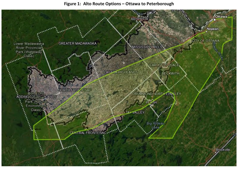
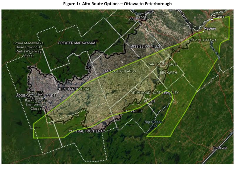
The assessment looked at areas within the City of Ottawa, Mississippi Mills, Carleton Place, Beckwith and Drummond North Elmesly before reaching Tay Valley Township.
In Tay Valley, MVCA regulates several wetlands, including Bolton Creek, Silver Lake, Little Mud Lake, Bennet Lake, Lower Fall River, Upper Fall river, and Playfairville-Mud.
According to the reportr, the preferred route through the township, based on mitigation opportunities, would be “to use the existing rail trail south of Highway 7 or the active rail corridor. This rail corridor services Omya Canada’s processing facility and avoids crossing major water bodies such as Bennett Lake, the Fall River, and the abundant wetlands within the Fall River subwatershed. This would also mitigate impacts to Silver Lake and Bennett Lake, the Bennett Lake Dam, and the monitoring stations and snow courses that support water management in this region. However, if wetlands are to be crossed large spans of raised tracks and/or a multitude of very large culverts would be needed to provide for continued water and wildlife passage and prevent significant changes in drainage patterns and the creation of new flood risk”
If the rail line runs further north, in Lanark Highlands, “It is recommended to avoid crossing or interfering with dam infrastructure and major water bodies such as Dalhousie Lake and the Mississippi River. An alignment along the existing northern hydro utility corridor would avoid most MVCA infrastructure but require a crossing of the Clyde River and a tributary near Cedardale.
Cedardale has been identified as one of the flood-prone areas along the Clyde River, therefore, any crossing within this area using the utility corridor would need to provide a crossing solution that does not have a negative impact on an already flood-prone area. As noted preciously, if wetlands are to be crossed large spans of raised tracks and/or a multitude of very large culverts would be needed to provide for continued water and wildlife passage and prevent significant changes in drainage patterns and the creation of new flood risks.
Because MVCA has extensive water management infrastructure in North Frontenac, it will be difficult to install a rail line “without impacting local hydrology, dams and monitoring locations. Siting along existing corridors would help to minimize impacts on local hydrology and MVCA assets but will invariably impact this largely natural landscape. While an alignment that follows the hydro line running parallel to North Frontenac Road 506 would be preferrable, there would still be several impacts.
These include, minimal distance between the corrifor and local lakes, proximity to the Mississagagon Lake dam, procimity to MNR dams and MVCA’s Palmerston-Canonto Conservation Area.
If this route were chosen, “vital road networks would need to be maintained through separated crossings” according to the report.
If the route runs through Central Frontenac, “It is recommended that any alignment remain north of Sharbot Lake, such as along or north of Highway 7, but avoid some of the larger lakes in the area such as Silver Lake, White Lake, and Bolton Lake. A focus along predeveloped corridors such as the Highway 7 corridor or the Hydro Corridor along Hwy 506 in North Frontenac are preferred.”
The report mentions Addington Highlands but points out that a MVCA has limited assets and limited information about Addington Highlands. It would be best for Quinte Region Conservation to address Addington Highlands