Citizen Geoscience via Granite Ridge
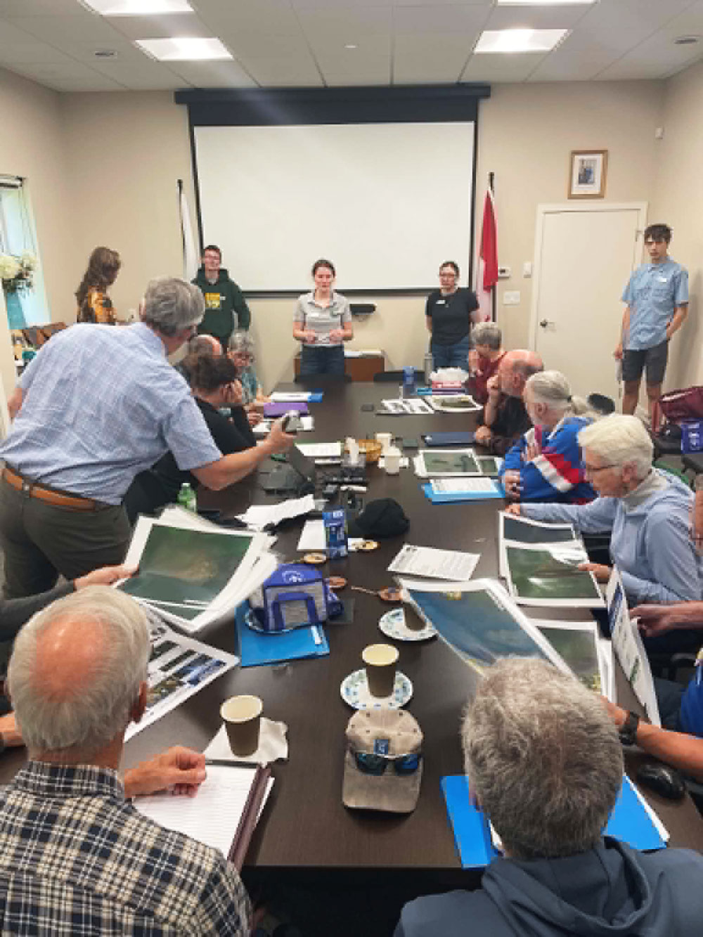
Members of Lake Associations from near and far gathered on the shore of Sharbot Lake in a grassy area behind the new Central Frontenac Township office building, last Friday (May 23) for a hands on drone demonstration and workshop, geared to efforts to monitor and control the influx of Eurasian water milfoil in their lakes.
The workshop was led by Wade Leonard, a teacher at Granite Ridge Education Centre in Sharbot Lake, and 5 students from the specialised class he runs on drone technology, Above and Beyond the Classroom, at Granite Ridge.
Participants came from the Sharbot Lake Property Owners Association, in Central Frontenac, the Malcolm and Ardoch Lake Association (MAALA) and Palmerston Lake Association in North Frontenac, as well as the Moira Lake Association, Chaffey’s Area Lakes Association and the Pike Lake Association.
All of the lakes share two things; an interest in how drone technology can be incorporated into citizen science on their lakes, and a Eurasian water milfoil infestation on their lakes.
The Granite Ridge drone class has a history with MAALA, having worked on their Eurasian milfoil abatement project, in year’s past.
Wade Leonard won an award in 2023 from the Royal Canadian Geographical Society for innovation in education for his work developing the drone class at Granite Ridge.
However, as he pointed out at the beginning of the workshop, the future of his class is in doubt, as program priorities in the school and the Limestone Board are always in flux, so he wants to pass on as much information as he can, to lake associations, so they can learn themselves how to operate drones, in order to track the milfoil and other invasive species that will come to their lakes in the future.
The drone used in the demonstrations, is one of a new class of drones that are very lightweight, under 250 grams, making it legal to fly them without a drone license, within prescribed parameters. This makes their application for citizen science more viable as they can be operated by any interested lake association member, and not just the ones who have taken the training and become licensed drone operators.
Ryleigh Rioux, who was one of the first drone class students, worked with MAALA when she was at Granite Ridge, and later, her undergraduate research project was located there as well. She helped develop the detailed imaging process that was being taught to the lake association volunteers at the workshop.
She was on hand to observe, and offer advice, to both the participants and her former teacher, on a break from her drone related job, in Nunavut. She will be returning to university in Ottawa next fall, for a masters program.
The workshop ran for a packed 90 minutes, using the waterfront location, as well as a room in the office that was provided by the township.
A description of the workshop, as provided by the organisers, is included below
Workshop Description
Granite Ridge Education Centre students helped lead a hands-on community workshop for local lake association members focused on using drone imagery, GIS mapping, and field observations to support lake monitoring of Eurasian water milfoil.
The workshop, held at the Central Frontenac Township office, introduced participants to a practical environmental monitoring workflow. The goal was not simply to demonstrate drone flying, but to show how aerial imagery, ground-level observations, local knowledge, and careful reporting, can work together to create better environmental evidence.
Participants rotated through two outdoor stations. At the drone station, students and staff demonstrated safe image collection, including high altitude, light, weather, image overlap, and repeatable flight methods that affect the usefulness of drone imagery. The group discussed how repeated flights over the same area can help lake associations compare conditions over time and document changes from season to season or year to year.
At the second station, participants used Survey123, a field data collection app, to practise “ground-truthing.” Ground-truthing means checking what appears in an aerial image against what is actually present on the ground or in the water. Participants learned how a single field record can include a location, photographs, description, confidence level, and notes, which can later be connected to a GIS map.
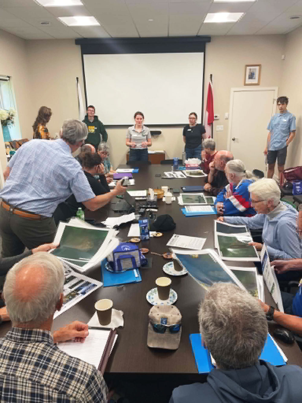
After the outdoor portion, the group moved inside to review drone imagery and discuss how images can be enhanced for interpretation. Students explained that small adjustments to brightness, contrast, highlights, shadows, clarity, and colour can make vegetation patterns easier to see, but that environmental images must not be over-edited in a way that changes or distorts the evidence.
The afternoon also included a hands-on imagery activity focused on aquatic vegetation and possible Eurasian water-milfoil identification. Participants examined sample drone imagery from local lakes, including Malcolm Lake, Sharbot Lake, White Lake, and Palmerston Lake, and discussed how to classify observations using careful language such as “possible,” “likely,” “confirmed,” and “uncertain.” This emphasised that drone imagery can show patterns, but that species identification requires supporting field evidence.
The workshop closed by looking at how drone images, Survey123 records, GIS maps, and local knowledge could be combined into a basic lake monitoring report. Such reports could include the purpose of the survey, weather conditions, drone methods, ground-truthing results, annotated images, maps, confidence levels, limitations, and recommendations for follow-up.
Overall, the event highlighted how student learning can connect directly to community needs. Students were not just demonstrating software or flying drones; they were helping local lake associations explore practical tools for documenting environmental change, identifying areas of concern, and communicating more clearly with municipalities, conservation authorities, and other partners.